Location: Western Africa, southeast of Algeria
Geographic coordinates: 16 00N, 8 00 E
Area: total: 1.267 million sq km,water: 300 sq km, land: 1,266,700 sq km
Area comparative: slightly less than twice the size of Texas
Border countries: Algeria 956 km, Benin 266km, Burkina Faso 628 km, Chad 1,175 km, Libya 354 km, Mali 821 km,Nigeria 1,497 km
Coastline:0 km (landlocked)
Climate: desert; mostly hot, dry, dusty; tropical in extreme south
Terrain: predominately desert plains and sand dunes; flat to rolling plains in south; hills in north
Elevation extremes: lowest point: Niger River 200m, highest point: Mont Bagzane 2,022 m
Natural resources: uranium,coal, iron ore, tin, phosphates, gold, petroleum
Land use: arable land: 3.54%, permanent crops: 0.01%, other: 96.45% (2001)
Natural hazards:recurring droughts
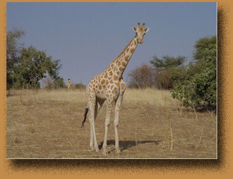
Environment - current issues:overgrazing; soil erosion; deforestation; desertification; wildlife populations (such as elephant, hippopotamus, giraffe, and lion) threatened because of poaching and habitat destruction.
Geography note: landlocked; one of the hottest countries in the world: northern four-fifths is desert, southern one-fifth is savanna, suitable for livestock and limited agriculture.
See Temperature and Rainfall in Niamey.
Source: CIA World Factbook